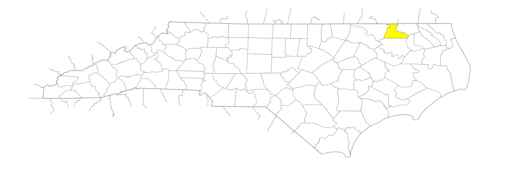
NC Gazetteer

Hertford County

… was formed in 1759 from Chowan, Bertie, and Northampton Counties. Located in the NE section of the state, it is bounded by Gates, Chowan, Bertie, and Northampton Counties and the state of Virginia. It was named for Francis Seymour Conway (1719-94), Earl (later Marquis) of Hertford, a Lord of the Bed Chamber and Knight of the Garter. Area: 361 sq. mi. County seat: Winton, with an elevation of 45 ft. Townships are Ahoskie, Harrellsville, Maneys Neck, Murfreesboro, St. Johns, and Winton. Produces peanuts, tobacco, corn, soybeans, cotton, hogs, livestock, apparel, lumber, steel products, glass products, and wooden containers.

beaches

Chowan Beach
Tuscarora Beach

branches

Banks Branch
Bells Branch
Chapel Branch
Deep Swamp Branch
Fort Branch
Hares Branch
Hot House Branch
Institute Branch
Knee Branch
Long Branch
Long Branch
Mare Branch
Marl Branch
Mill Branch
Snake Branch
Turnpike Branch

businesses or business districts

No Grease

communities

Agate
Agnela
Bartonsville
Bethlehem
Britts Store
California
Cofield
Earleys
Fraziers Crossroads
Halls
High Hill
Lloyd Crossroads
Lotta
Menola
Mill Neck
Mink Neck
Mintons Store
Newsome Store
Oak Villa
Pettys Shore
Pilands Crossroads
Pine Tree Store
Pleasant Plains
Poor Town
Riddicksville
Sally Archer Crossroads
South Tunis
Tunis
Union
Wickacon

creeks

Ahoskie Creek
Brooks Creek
Catharine Creek
Chinkapin Creek
Currituck Creek
Indian Creek
Keel Creek
Liverman Creek
Potecasi Creek
Stoney Creek
Turkey Creek
Turkey Creek

former communities

Pitch Landing

guts

Hall's Gut

historical markers

4-H Club historical marker
Burning Of Winton historical marker
Choanoac historical marker
Chowan Academy historical marker
Chowan University historical marker
Dr. Walter Reed historical marker
F. Roy Johnson historical marker
John H. Wheeler historical marker
John W. Moore historical marker
Lafayette historical marker
Lane's Expedition historical marker
Lemuel W. Boone 1827-1878 historical marker
Meherrin Town historical marker
Murfree House historical marker
Potecasi Creek historical marker
Richard J. Gatling historical marker
Robert Lee Vann 1879-1940 historical marker
Wesleyan Female College historical marker

islands

Buffalo Island
Dowry Island

Native American settlements

Nansemond Indian Town

parishes

Northwest Parish
St. Barnabas’ Parish

ponds

Hare's Mill Pond
Livermans Mill Pond
Sessoms Mill Pond
Swains Mill Pond
Worrells Mill Pond

regions

Coastal Plain
Coastal Plain Dialect Region
VA Piedmont Dialect Region

rivers

Blackwater River
Chowan River
Meherrin River
Nottoway River
Wiccacon River

schools

C.S. Brown School Auditorium
CS Brown High
Catherine Hayes School
Hertford County Early College
Hertford County High
Mill Neck School
Mt. Sinai School
Murfreesboro School
Pleasant Plains School
Rosenwald School at Saint Johns Baptist Church
Vaughantown School

swamps

Ahoskie Swamp
Bear Swamp
Flat Swamp
Hoggard Swamp
Horse Swamp
Kill'em Swamp
Old Tree Swamp
Painter Swamp
Panther Swamp
Whiteoak Swamp

towns

Ahoskie
Como
Harrellsville
Mapleton
Murfreesboro
Winton

townships

Ahoskie Township
Harrellsville Township
Maneys Neck Township
Murfreesboro Township
St. Johns Township
Winton Township

transportation-related places

Boons Ferry
Brittle's Ferry
Hill's Bridge

villages

Chawanoac
Tiancok