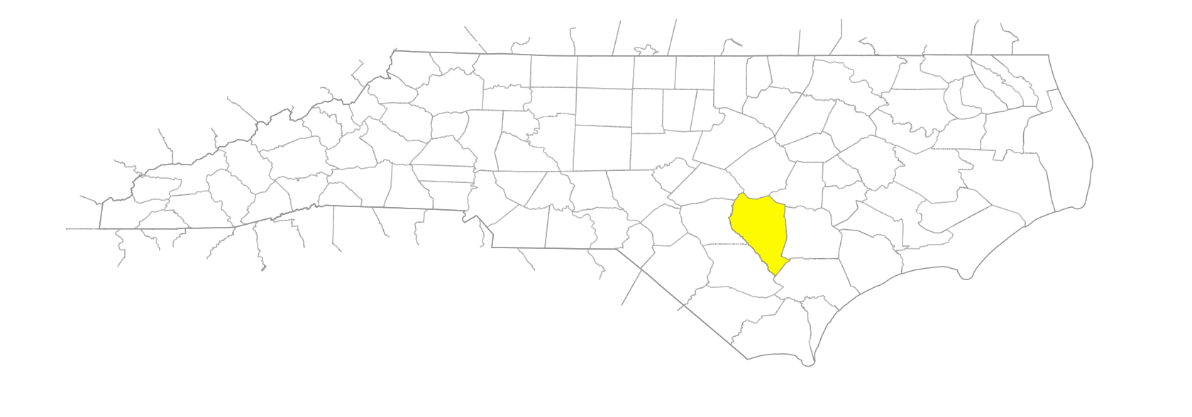
NC Gazetteer

Sampson County

… was formed in 1784 from Duplin County. Located in the E section of the state, it is bounded by Wayne, Duplin, Pender, Bladen, Cumberland, Johnston, and Harnett Counties. It was named for Col. John Sampson (d. 1784), member of the House of Commons and the governor's council under royal governors Dobbs, Tryon, and Martin. Area: 963 sq. mi. County seat: Clinton, with an elevation of 158 ft. Townships are Belvoir, Dismal, Franklin, Hales, Herrings, Honeycutts, Lisbon, Little Coharie, McDaniels, Mingo, Newton Grove, North Clinton, Piney Grove, Plain View, South Clinton, South River, Taylors Bridge, Turkey, and Westbrook. Produces corn, soybeans, wheat, oats, hay, peanuts, tobacco, cotton, cucumbers, pepper, squash, watermelons, cantaloupe, collards, honey, nursery products, miscellaneous vegetables and fruit, poultry, hogs, livestock, turkeys, sweet potatoes, lumber, processed meat, electronics, apparel, concrete products, and textiles.

bays

Dismal Bay
Gap Bay
Harvel Bay
Keiths Bay
Pigeon Flats Bay
Prissy Bay

branches

Cong Branch
McPhail Branch
Meetinghouse Branch
Rowan Branch
Williams Old Mill Branch

communities

Alpine
Arcot
Beamans Crossroads
Bearskin
Beulah
Blackman's Mills
Blake
Bland
Butlers Crossroads
Chance
Clear Run
Clement
Concord
Dalila
Delta
Delway
Dismal
Easy Street
Elliott
Giddensville
Giles’ Mills
Hargrove Crossroads
Hawley's Store
Hayne
Herring
Hives
Hobbton
Hobton
Huntley
Ingold
Ivanhoe
Jackson's Cornre
Keener
Kerr
Kitty Fork
Lissa
Lydia
Maitland
McCoy
McCullen
McDaniel
McKoy
McLamb Crossroads
Mingo
Mintz
Mix
Moltonville
Monks Crossroads
Newtons Crossroads
Ora
Orange
Piney Green
Poplar Grove
Red Hill
Rosin Hill
Shadygrove
Shanghai
Six Runs
Spiveys Corner
Suttontown
Taylors Bridge
Timothy
Tippecanoe
Tomahawk
Waycross

creeks

Big Beaverdam Creek
Big Tomahawk Creek
Crane Creek
Doctors Creek
Enoch Mill Creek
Great Coharie Creek
Little Coharie Creek
Little Tomahawk Creek
Mill Creek
Six Runs Creek
Stewart Creek
Tomahawk Creek
Turkey Creek

elevations

Bloody Bluff

former communities

Clinton Township
Lisbon

historical markers

Black River Church historical marker
Gabriel Holmes 1769-1829 historical marker
Gun Factory historical marker
Marion Butler historical marker
Pineland College- Edwards Military Institute historical marker
Richard Clinton historical marker
Steamboat Trade historical marker
Thomas O. Moore 1804-1876 historical marker
Wells Chapel Baptist Church historical marker
William Rufus King historical marker

lakes

Williams Lake

millponds

Bradshaws Millpond

pocosins

Bear Pocosin
Big Dismal
Bull Pocosin
Burnt Pocosin

ponds

Haynes Pond
House's Mill Pond
McLamb Mill Pond

regions

Coastal Plain
Coastal Plain Dialect Region

rivers

Coharie River
South River

runs

Stokes Mill Run

schools

Clinton High School
Hobbton High School
Lakewood High School
Midway High School
Richmond High School
Sampson County Training School
Sampson Early College High
Snow Hill School
White Oak School

swamps

Bearskin Swamp
Beaverdam Creek
Beaverdam Swamp
Beaverdam Swamp
Beaverdam Swamp
Bulltail Swamp
Caesar Swamp
Clear Run Swamp
Craddock Swamp
Cuwhiffle Swamp
Gilmore Swamp
Goshen Swamp
Hoe Swamp
Hog Island Swamp
Hornet Swamp
Jones Swamp
Keiths Swamp
Kill Swamp
Little Beaverdam Swamp
Marsh Swamp
Merkle Swamp
Mill Swamp
Mill Swamp
Mill Swamp
Old Mill Swamp
Opossum Swamp
Pharisee Swamp
Rye Swamp
Sevenmile Swamp
Tenmile Swamp
Twomile Swamp
Ward Swamp
Whiteoak Swamp
Wildcat Swamp
Youngs Swamp

towns

Autryville
Clinton
Garland
Harrells
Newton Grove
Parkersburg
Roseboro
Salemburg
Taylorsville
Turkey

townships

Belvoir Township
Dismal Township
Franklin Township
Halls Township
Herrings Township
Honeycutts Township
Lisbon Township
Little Coharie Township
McDaniels Township
Mingo Township
Newton Grove Township
North Clinton Township
Piney Grove Township
Plain View Township
South Clinton Township
South River Township
Taylors Bridge Township
Turkey Township
Westbrooks Township