NC Gazetteer

Ashe County

… was formed in 1799 from Wilkes County. In the NW corner of the state, it is bounded by the states of Tennessee and Virginia and by Alleghany, Wilkes, and Watauga Counties. It was named for Samuel Ashe (1725-1813), Revolutionary patriot, superior court judge, and governor of the state (1795-98). Area: 427 sq. mi. County seat: Jefferson, with an elevation of 2,900 ft. Townships are Chestnut Hill, Clifton, Creston, Elk, Grassy Creek, Helton, Horse Creek, Hurricane, Jefferson, Laurel, North Fork, Obids, Oldfields, Peak Creek, Pine Swamp, Piney Creek, Pond Mountain, Walnut Hill, and West Jefferson. Produces corn, tobacco, Christmas trees, rubber products, wood products, hay, dairy livestock, chemicals, textiles, hosiery, furniture, and electronics. Home to a cheese plant in West Jefferson. Copper and mica are mineral products, and the county has a potential for the production of stone, iron ore, and gem stones.
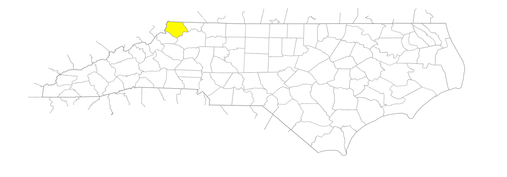
branches

Grass Branch
Long Shore Branch
Old Field Branch
Rocky Shoal Branch
Sugar Tree Branch

communities

Amy
Apple Grove
Ashland
Ashley
Baldwin
Ball
Beaver Creek
Benge
Bernice
Bina
Blevins
Brandon
Bristol
Bud
Burnthill
Chestnut Hill
Clifton
Comet
Creston
Crumpler
Dandy
Dresden
Eye
Farmers Store
Fig
Fleetwood
Furches
Gale
Gap Creek
Glendale Springs
Grassy Creek
Graybeal
Grayson
Green Valley
Grimsley
Helton
Hemlock
Hermitage
Husk
Idlewild
Idol
Index
Lamar
Linney
Milam
Nathans Creek
Nettle Knob
Obids
Orion
Othello
Oval
Parker
Pinckton
River Side
Roten
Scottville
Shatley Springs
Silas Creek
Sly
Smethport
Sturgills
Sussex
Sutherland
Thaxton
Toliver
Transon
Treetop
Trout
Tuckerdale
Venus
Vernon
Wagoner
Weasel
Weaversford
Woodford

creeks

Bear Creek
Beaver Creek
Ben Bolen Creek
Big Horse Creek
Big Laurel Creek
Buffalo Creek
Copeland Creek
Cranberry Creek
Cranberry Creek
Deep Gap Creek
Dog Creek
Elk Creek
Grassy Creek
Grassy Creek
Helton Creek
Laurel Creek
Little Gap Creek
Little Helton Creek
Little Horse Creek
Little Laurel Creek
Long Hope Creek
Meadow Creek
Middle Fork Little Horse Creek
Mill Creek
Naked Creek
Nathans Creek
Obids Creek
Peak Creek
Phoenix Creek
Piney Creek
Piney Fork Creek
Rich Hill Creek
Roan Creek
Rock Creek
Roundabout Creek
Silas Creek
South Fork Little Horse Creek
Stagg Creek
Three Top Creek
West Beaver Creek
Windfall Creek

forks

Brush Fork
Hoskin Fork
Roaring Fork

former communities

Ore Knob

gaps

Benge Gap
Cut Laurel Gap
Daniels Gap
Gillam Gap
Horse Gap
Jacob's Gap
Miller Gap
Phillips Gap

historical markers

Asa Gray historical marker
North Carolina-Virginia historical marker
Ore Knob Mine historical marker

knobs

Thompkins Knob

mountain ranges

Stone Mountains

mountains

Big Bald Mountain
Bluff Mountain
Mount Jefferson
Old Field Bald Mountain
Paddy Mountain
Phoenix Mountain
Pond Mountain
Simone Mountain
Three Top Mountain
Walnut Hill

regions

Appalachian Dialect Region

ridges

Elk Ridge

rivers

North Fork New River
South Fork New River

schools

Ashe County Early College High
Ashe County High School

swamps

Pine Swamp

towns

Jefferson
Lansing
Todd
Warrensville
West Jefferson

townships

Chestnut Hill Township
Clifton Township
Creston Township
Elk Township
Grassy Creek Township
Helton Township
Horse Creek Township
Hurricane Township
Jefferson Township
Laurel Township
North Fork Township
Obids Township
Oldfields Township
Peak Creek Township
Pine Swamp Township
Piney Creek Township
Pond Mountain Township
Walnut Hill Township
West Jefferson Township