NC Gazetteer

Chatham County

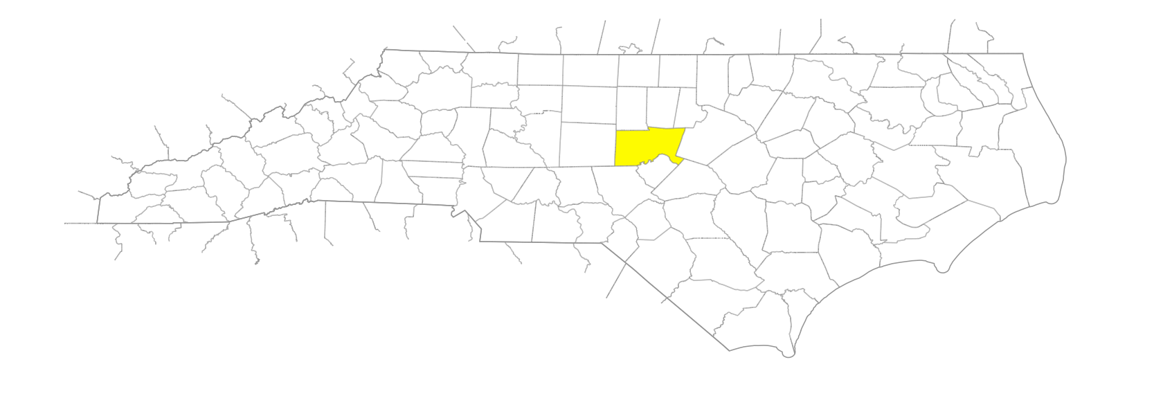
… was formed in 1771 from Orange County. Located in the central section of the state, it is bounded by Wake, Harnett, Lee, Moore, Randolph, Alamance, Orange, and Durham Counties. It was named for William Pitt, Earl of Chatham (1708-78), who vigorously opposed the harsh measures taken in England with regard to the American colonies in 1774-75 and who advocated cessation of hostilities in 1777. Area: 707 sq. mi. County seat: Pittsboro, with an elevation of 409 ft. Townships are Albright, Baldwin, Bear Creek, Cape Fear, Center, Gulf, Hadley, Haw River, Hickory Mountain, Matthew, New Hope, Oakland, and William. Produces wheat, oats, livestock, poultry, hay, corn, furniture, plywood, bricks, mobile homes, nursery products, textiles, hosiery, crushed stone, and clay for brick.
areas

Devil's Tramping Ground

branches

Rocky Branch

businesses or business districts

Wilcox Iron Works

communities

Bear Creek
Beaumont
Bona
Bonlee
Brickhaven
Brushcreek
Bynum
Carbonton
Coalglen
Corinth
Evans
Farrington
Goff
Gravel Spring
Griffins Crossroads
Hadleys Mill
Harpers Crossroads
Headwater
Kilgo
Kimbolton
Leota
Lindhurst
Lockport
Lutterloh
Marleys Mill
Mount Vernon Springs
Mud Lick
Pluck
Providence
Rabbits Crossroads
Riggsbee
Roscoe
Seaforth
Silk Hope
Simmon Grove
Sylvester
Tillman
Truth
Upland
Wilsonville

creeks

Bear Creek
Beartree Creek
Beaver Creek
Bloodrun Creek
Buckhorn Creek
Bush Creek
Collins Creek
Cub Creek
Dry Creek
Ferrells Creek
Gulf Creek
Hollands Creek
Indian Creek
Kit Creek
Lacys Creek
Landrum Creek
Lick Creek
Little Beaver Creek
Little Indian Creek
Loves Creek
Meadow Creek
Morgan Creek
Neville Creek
Northeast Creek
Obies Creek
Overcup Creek
Panther Creek
Parkers Creek
Pitts Creek
Pokeberry Creek
Robeson Creek
Shaddox Creek
Stinking Creek
Terrell Creek
Tick Creek
Weaver Creek
Whiteoak Creek
Whiteoak Creek
Wilkinson Creek

forests

Hope Valley Forest

former communities

Moncure
Prince's Bridge

geological formations

Hollow Rock

historical markers

Abraham Rencher historical marker
Captain Johnston Blakeley historical marker
Charles Manly historical marker
Coal Glen Mine Disaster historical marker
George Moses Horton historical marker
Granville Grant historical marker
Henry A. London 1846-1918 historical marker
James I. Waddell historical marker
John Owen 1787-1841 historical marker
O'Kelly Chapel Christian Church historical marker
Paul Green 1894-1981 historical marker
Ramsey's Mill historical marker
Rocky River Church historical marker
Rocky River Friends Meeting historical marker
Tory Raid historical marker
Wilcox Iron Works historical marker

islands

Farrars Island
McKay Island

lakes

Buckhorn Lake
Jordan Lake

mountains

Beck Mountain
Edwards Mountain
Hickory Mountain
Oaky Mountain
Round Top Mountain
Terrell Mountain

parishes

St. Bartholomew's Parish

points of interest

Geographic Center

regions

Piedmont Dialect Region

rivers

Cape Fear River
Deep River
Haw River
New Hope River
Rocky River

schools

Chatham Central High School
Chatham Charter
Chatham School of Science & Engineering
Chatham Youth Development Center
Gees Grove School
Gum Springs School
Haywood School
Jordan-Matthews High School
Mitchell's Chapel School
Northwood High School
Pittsboro School
SAGE Academy
Siler City (Training) School
Woods Charter School
Zion School

towns

Bennett
Goldston
Gulf
Haywood
Merry Oaks
Pittsboro
Siler City

townships

Albright Township
Baldwin Township
Bear Creek Township
Cape Fear Township
Center Township
Gulf Township
Hadley Township
Haw River Township
Hickory Mountain Township
Matthews Township
New Hope Township
Oakland Township

transportation-related places

Cyprett's Bridge

waterfalls

Buckhorn Falls