NC Gazetteer

Wilson County

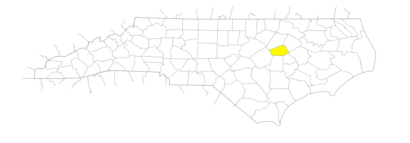
… was formed in 1855 from Edgecombe, Nash, Johnston, and Wayne Counties. Located in the E central section of the state, it is bounded by Pitt, Greene, Wayne, Johnston, Nash, and Edgecombe Counties. It was named for Louis D. Wilson (1789-1847), delegate to the Constitutional Convention of 1835 and an officer in the War with Mexico. Area: 373 sq. mi. County seat: Wilson, with an elevation of 147 ft. Townships are Black Creek, Cross Roads, Gardner, Old Fields, Saratoga, Springhill, Stantonsburg, Taylor, Toisnot, and Wilson. Produces tobacco, corn, wheat, oats, soybeans, cotton, poultry, tobacco products, textiles, apparel, tires, sweet potatoes, concrete pipe, motor-vehicle parts, lumber products, and processed meat.
branches

Buck Branch
Buckhorn Branch
Cattail Branch
Cedar Branch
Dickinson's Branch
Etheridge's Branch
Farmer's Branch
Gardner's Branc
Godwin's Branch
Horn's Branch
Huckleberry Branch
Mare Branch
Meeting House Branch
Mill Branch
Mill Branch
Mill Branch
Morgan's Branch
Page's Branch
Robin Branch
Rocky Ford Branch
Shepherd's Branch
Spring Branch
Tobie's Branch
Williamson Branch

cities

Wilson

communities

Aycock
Aycock Crossing
Barnes Store
Batts Crossroads
Buckhorn Crossroads
Cefare
Cliftonville
Cobbs Crossroads
Connor
Dixie
Drivers Store
Edam
Encas
Evansdale
Filmore
Frederick
Hawra
Healthy Plain
Holden's Crossroads
Lamm's
Lamm's Crossroads
Meeksville
Moores Crossroads
Neverson
New Hope
Pender's Crossroads
Rock Ridge
Rosebud
Scott's
Stotts Crossroads
Sun
Talbot
Westover
Wilbanks
Wilkerson Crossroads

creeks

Black Creek
Contentnea Creek
Juniper Creek
Little Contentnea Creek
Millstone Creek
Moccasin Creek
Moccasin Creek
Town Creek
Turkey Creek

depressions

Hobby Hole, The

former communities

Hominy Heights
Joyner's
Stantonsburg

guts

Stanton's Gut

historical markers

Barton College historical marker
Charles Lee Coon 1868-1927 historical marker
Elizabeth Gold Swindell historical marker
First Abc Store historical marker
Gen. W. D. Pender historical marker
Hackney Wagon Company historical marker
Henry G. Connor 1852-1924 historical marker
Military Hospital historical marker
Owen L. W. Smith historical marker
P. D. Gold 1833-1920 historical marker
Peacock's Bridge historical marker
Plank Road historical marker
R. D. W. Connor historical marker
Toisnot Church historical marker

lakes

Contentnea Lake
Silver Lake

ponds

Finch's Mill Pond
Scott's Pond
Wilson's Pond
Woodard's Pond

regions

Coastal Plain
Coastal Plain Dialect Region

runs

Ward Run

schools

Beddingfield High
Charles H. Darden High School
Daniels Learning Center
Eastern North Carolina School for the Deaf
Evansdale School
Holden School
James Hunt High
Jones Hill School
Kirby's Crossroads School
Lucama School
New Vester School
Ralph L. Fike High School
Rocky Branch School
Saratoga School
Sims School
Stantonsburg School
Williamson School
Wilson Academy of Applied Technology
Wilson Early College Academy
Wilson Preparatory Academy
Yelverton School

swamps

Aycock Swamp
Bloomery Swamp
Brand Swamp
Cattail Swamp
Goss Swamp
Great Swamp
Hominy Swamp
Lee Swamp
Marsh Swamp
Toisnot Swamp
Turner Swamp
Wheat Swamp
White Swamp
Whiteoak Swamp

towns

Black Creek
Boyette
Bridgersville
Elm City
Lucama
Saratoga
Sharpsburg
Sims
Town Creek

townships

Black Creek Township
Crossroads Township
Garden Township
Old Fields Township
Saratoga Township
Springhill Township
Stantonsburg Township
Taylor Township
Toisnot Township
Wilson Township

transportation-related places

Indian Ford
Peacock's Bridge
Tartt Path

villages

Torhunta