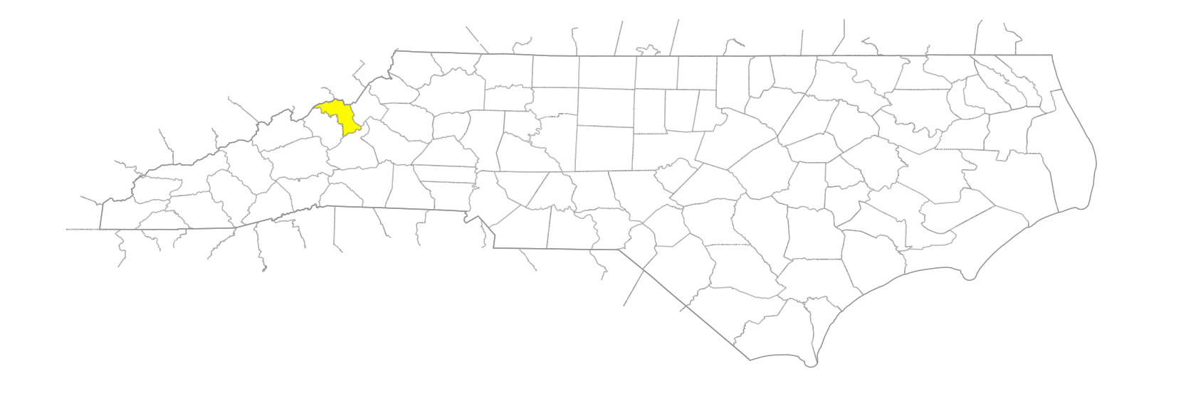
NC Gazetteer

Mitchell County

… was formed in 1861 from Yancey, Watauga, Caldwell, Burke, and McDowell Counties. Located in the W section of the state, it is bounded by the state of Tennessee and by Avery, McDowell, and Yancey Counties. It was named for Elisha Mitchell (1793-1857), professor at the University of North Carolina who was killed while exploring the peak that now bears his name—the highest point E of the Mississippi. Area: 220 sq. mi. County seat: Bakersville, with an elevation of 2,550 ft. Townships are Bakersville, Bradshaw, Cane Creek, Fork Mountain, Grassy Creek, Harrell, Little Rock Creek, Poplar, Red Hill, and Snow Creek. Produces tobacco, Christmas trees, apples, corn, hay, dairy products, livestock, textiles, apparel, hosiery, lumber, mica, gypsum, feldspar, kaolin, and quartz.

areas

Bailey Meadows
Dogwood Flats
Haw Patch
Hickory Flats

balds

Big Bald
Grassy Ridge Bald
Jane's Bald
Little Bald
Round Bald

branches

Aaron Branch
Banjo Branch
Barnett Branch
Bee Branch
Big Branch
Biggerstaff Branch
Bill Davenport Branch
Blevins Branch
Broad Branch
Carvers Branch
Chestnut Branch
Cooper Branch
Deer Lick Branch
Dobson Branch
Dry Branch
Duck Branch
Duck Branch
Edwards Branch
Elk Branch
English Branch
Flat Branch
Gouge Branch
Griffith Branch
Hanging Rock Branch
Holley Branch
Honeycutt Branch
Hughes Branch
Jackson Branch
Johns Camp Branch
Laurel Branch
Lily Branch
Little Laurel Branch
Long Branch
Melton Branch
Middle Ridge Branch
Miller Branch
Mine Fork Branch
Pine Branch
Pine Branch
Pineroot Branch
Piney Branch
Powers Branch
Pump Branch
Reddix Branch
Rich Branch
Roaring Branch
Rose Branch
Sams Branch
Sandy Branch
Shop Branch
Smith Branch
Soapstone Branch
Sugartree Branch
Sullins Branch
Warrick Branch
Waterfall Branch
Whitson Branch

communities

Altapass
Bailey
Bandana
Brummett Creek
Brundana
Buladean
Clarissa
Clarrissa
Cloudland
Cooktown
Estatoe
Ewart
Forbes
Glen Ayre
Green Cove
Hawk
Herrells
Honeycutt
Huntdale
Kalmia
Kona
Ledger
Loafers Glory
Lunday
Minpro
Mount Mitchell
Penland
Peppers
Peterson
Pigeonroost
Poplar
Red Hill
Relief
Roses Branch
Snow Creek
Tipton Hill
Toecane
Upper Pigeonroost
Upper Poplar
Webb
Wing

coves

Wiggins Cove
Young Cove

creeks

Bad Creek
Bean Creek
Bear Creek
Bearpen Creek
Bearwallow Creek
Beaver Creek
Bee Creek
Beech Creek
Beetree Creek
Big Rock Creek
Big Spring Creek
Bird Creek
Bowling Green Creek
Brummett Creek
Brushy Creek
Cane Creek
Carvers Gap Creek
Charles Creek
Cub Creek
East Fork Crabtree Creek
East Fork Grassy Creek
Fall Creek
Falls of Gouges Creek
Gouges Creek
Grassy Creek
Graveyard Creek
Greasy Creek
Green Cove Creek
Gutches Creek
Hawk Creek
Hobson Creek
Holder Creek
Hollow Poplar Creek
Hughes Creek
Justice Creek
Laurel Creek
Left Fork Bean Creek
Little Bear Creek
Little Rock Creek
Little Rose Creek
Lyddies Creek
Mine Creek
Pate Creek
Pigeonroost Creek
Raccoon Creek
Rebels Creek
Reuben Creek
Right Fork Bean Creek
Rockhouse Creek
Rose Creek
Shinbone Creek
Snow Creek
Spring Creek
Stagger Weed Creek
Sweet Creek
Tom Creek
Wiles Creek
Young Cove Creek

forests

Pisgah National Forest

forks

Camping Fork
Leathermans Fork
Left Fork [Cane Creek]
Middle Fork [Grassy Creek]
North Fork [Carvers Branch]
North Fork [Grassy Creek]
Right Fork [Cane Creek]
Right Fork [Pigeonroost Creek]
South Fork [Carvers Branch]

gaps

Ashe Gap
Bearwallow Gap
Beauty Spot Gap
Big Spring Gap
Brandy Gap
Buckeye Gap
Carvers Gap
Cherry Gap
Deep Gap
Deerlick Gap
Deerplay Gap
Engine Gap
Garland Gap
Gillespie Gap
Gooch Gap
Grassy Gap
Heffner Gap
Houston Gap
Hughes Gap
Hughes Gap
Indian Grave Gap
Iron Mountain Gap
Jackson Gap
Lynn Gap
McCall Gap
McKinney Gap
Peterson Gap
Pumpkin Patch Gap
Rock Creek Gap
Sarvis Gap
Sparks Gap
Swafford Gap

hills

Iowa Hill
Mine Hill

historical markers

Andre Michaux historical marker
Asa Gray historical marker
Penland School historical marker
Sink Hole Mine historical marker
Spruce Pine Mining District historical marker

knobs

Arnold Knob
Arturs Knob
Bad Knob
Bent Knob
Dula Knob
Elkwallow Knob
English Knob
Gouge Knob
Grassy Knob
High Knob
High Knob
Ivy Knob
Jackson Knob
Little Bald Knob
Little Rock Knob
Locust Knob
Loggy Knob
Pine Knob
Pine Knob
Rich Knob
Roan High Knob
Shepherd Knob
Stony Knob
Wilson Knob
Woods Knob

mountain features

Eagle Cliff
Nettle Patch
Peak, The
Raven Cliffs
Roan High Bluff

mountain ranges

Unaka Mountains

mountains

Bald Mountain
Bald of Humpback Mountain
Beartown Mountain
Beauty Spot
Big Yellow Mountain
Burns Mountain
Chalk Mountain
Crabtree Mountain
Devils Nest
Ellis Mountain
Ephraim Place
Fork Mountain
Gouge Mountain
Hawk Mountain
Iron Mountain
Lightwood Mountain
Little Hawk Mountain
Little Mountain
Little Yellow Mountain
Long Level Mountain
Meadlock Mountain
Pine Mountain
Pisgah Mountain
Pumpkin Patch Mountain
Rich Mountain
Roan Mountain
Rock Creek Mountain
Round Mountain
Shepherd Mountain
Spear Tops Mountain
Tempa Mountain
Unaka Mountain
Valhalla Dome
White Rocks
Whiting Spur
Yellow Spot

regions

Appalachian Dialect Region

ridges

Bearpen Ridge
Beartown Ridge
Bee Ridge
Bent Ridge
Big Ridge
Big Ridge
Briarpatch Ridge
Buck Ridge
Carters Ridge
Charlies Ridge
Chestnut Ridge
Chimney End Ridge
Feeding Ridge
Fork Ridge
Fork Ridge
Grassy Ridge
Haw Ridge
Hurricane Ridge
Laurel Ridge
Laurel Ridge
Leading Ridge
Lick Ridge
Little Fork Ridge
McKinney Ridge
Middle Ridge
Mine Fork Ridge
Old Road Ridge
Pine Ridge
Pine Ridge
Pony Ridge
Rattlesnake Ridge
Road Ridge
Sarvis Ridge
Shell Ridge
Sparks Ridge
Spur Ridge
Sugartree Ridge
White Rock Ridge
Wolf Ridge
Wolf Ridge
Wolfden Ridge

rivers

Cane River
Nolichucky River
North Toe River
Toe River

rocks

Hanging Rock

runs

Silver Run

schools

Mayland Early College
Mitchell High School

tops

Rube Green Top

towns

Bakersville
Spruce Pine

townships

Bakersville Township
Bradshaw Township
Cane Creek Township
Fork Mountain Township
Grassy Creek Township
Harrell Township
Little Rock Creek Township
Poplar Township
Red Hill Township
Snow Creek Township

valleys

Buchanan Hollow
Dellinger Hollow
Hill Hollow
Hootowl Hollow
Jake Hollow
Jarrett Hollow
Long Hollow
Polly Hollow
Roan Valley
Stony Valley

waterfalls

Crabtree Falls
Murphy Falls