NC Gazetteer

Clay County

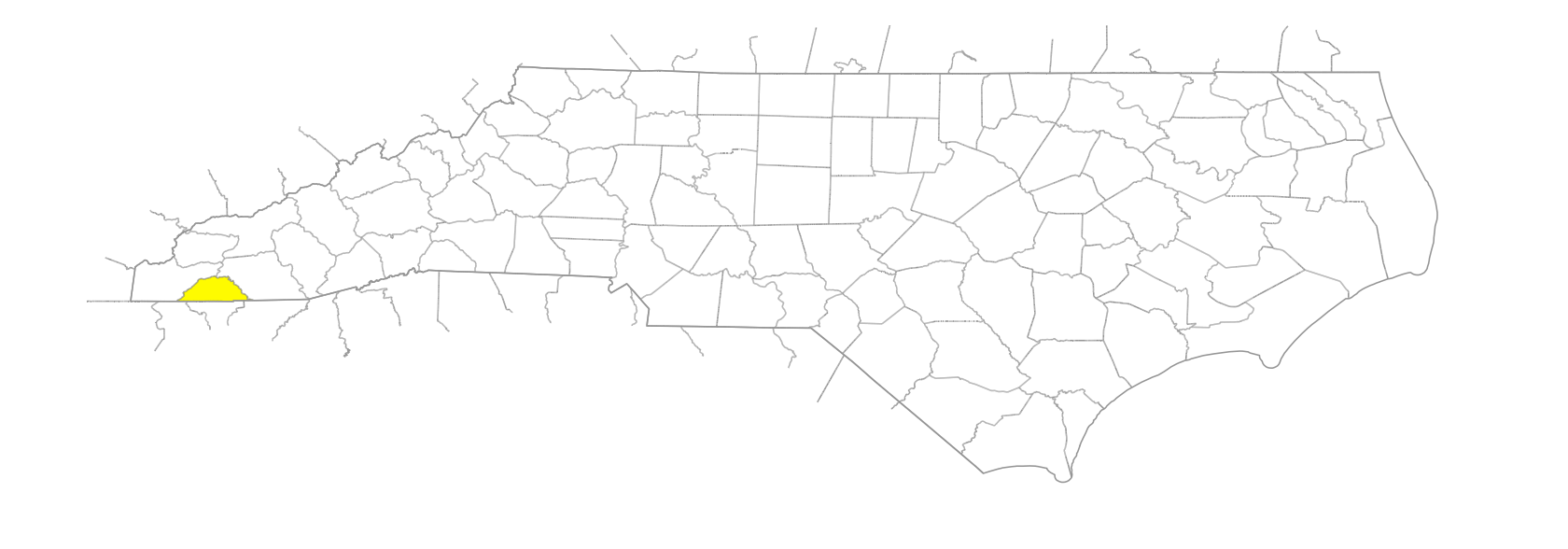
… was formed in 1861 from Cherokee County. In the W section of the state, it is bounded by the state of Georgia and by Cherokee and Macon Counties. It was named for Kentucky senator Henry Clay (1777-1852). Area: 219 sq. mi. County seat: Hayesville, with an elevation of 1,893 ft. Townships are Brasstown, Hayesville, Hiwassee, Shooting Creek, Sweetwater, and Tusquittee. Produces corn, cable, cattle, hay, poultry, lumber, and apparel.
balds

Big Peachtree Bald
Court House Bald
Kimsey Bald
Little Bald
Matlock Bald
Penland Bald
Potrock Bald
Shooting Creek Bald
Signal Bald
Tusquitee Bald
Weatherman Bald
West Bald

branches

Allbone Branch
Anderson Branch
Bald Spring Branch
Barrett Branch
Betty Branch
Black Branch
Bluff Branch
Bob Branch
Boone Branch
Bristol Branch
Buchanan Branch
Byers Branch
Caesar Austin Branch
Camp Branch
Carroll Branch
Chairmaker Branch
Cherry Cove Branch
Chestnut Branch
Church Branch
Clabber Branch
Cold Branch
Cold Spring Branch
Collett Camp Branch
Copper Mine Branch
Crawford Branch
Davenport Branch
Davenport Branch
Evans Branch
Fishprong Branch
Flint Spring Branch
Glade Branch
Hogan Branch
Hothouse Branch
Jackie Branch
Jake Branch
Jake Cove Branch
John Reese Branch
Johnson Branch
Leatherwood Branch
Ledford Branch
Loggy Branch
Long Branch
Long Branch
Long Branch
Lyon Branch
Moffet Branch
Moores Branch
Morgan Branch
Moss Branch
Muskrat Branch
Nane Branch
Nattie Branch
Needmore Branch
Owens Branch
Passmore Branch
Paynes Branch
Potrock Branch
Rocking Chair Branch
Rocky Branch
Sapsucker Branch
Sassafras Branch
Steve Branch
Stevens Branch
Suddawig Branch
Sunday Branch
Tate Branch
Thumping Branch
Tipton Branch
Trout Cove Branch
Will Mason Branch

communities

Auberry
Brasstown
Carter Cove
Corundum
Crit
Elf
Irena
Lick Log Creek
Ogden
Pinelog
Scrougetown
Shooting Creek
Tusquitee
Warne

coves

Bull Cove
Carter Cove
Hogsed Cove
Holden Cove
Holden Cove
Horselot Cove
Joel Cove
Milksick Cove
Riley Cove
Sugar Cove
Winchester Cove

creeks

Barnett Creek
Beach Creek
Beech Creek
Blair Creek
Brasstown Creek
Buck Creek
Burntcabin Creek
Carver Creek
Clear Creek
Coleman Creek
Compass Creek
Crawford Creek
Downing Creek
Eagle Creek
Fires Creek
Giesky Creek
Greasy Creek
Greasy Creek
Hickory Cove Creek
Hurricane Creek
Hyatt Mill Creek
Johnson Mill Creek
Lick Log Creek
Little Buck Creek
Little Fires Creek
Little Tuni Creek
Matlock Creek
Mill Creek
Peckerwood Creek
Perry Creek
Pinelog Creek
Pounding Creek
Qualls Creek
Rock House Creek
Rogues Creek
Shearer Creek
Shooting Creek
Sneeky Creek
Sweetwater Creek
Town Creek
Tuni Creek
Tusquitee Creek
Vineyard Creek
Wateroak Creek
Webb Creek
Winchester Creek

forests

Nantahala National Forest

forks

Left Fork [Eagle Creek]
North Fork
Right Fork [Eagle Creek]

gaps

Bear Gap
Bear Pen Gap
Bearpen Gap
Beech Gap
Beech Gap
Black Gap
Bly Gap
Brasstown Gap
Carrol Gap
Carter Gap
Carver Gap
Coleman Gap
Deep Gap
Glade Gap
Grassy Gap
Ledford Gap
Park Gap
Perry Gap
Russell Gap
Sweetwater Gap
Tate Gap
Tuni Gap
Tusquitee Gap
Wateroak Gap
Will Mason Gap
Winfrey Gap

historical markers

Fort Hembree historical marker
George W. Truett historical marker
John C. Campbell Folk School historical marker

knobs

Ammon Knob
Ash Knob
Beal's Knob
Bell Knob
Big Kitchens Knob
Big Milksick Knob
Big Stamp Knob
Birch Knob
Carrell Knob
Carroll Knob
Chestnut Stamp Knob
Defeat Knob
Doe Knob
Joe Knob
Julie Knob
Peachtree Knob
Pine Knob
Plot Knob
Riley Knob
Sassafras Knob
Stamy Knob
Whiteoak Knob

lakes

Carroll Lake
Chatuge Lake
Nantahala Lake

mountain features

Big Pine Ridg
Double Knobs

mountain ranges

Tusquitee Mountains
Valley River Mountains

mountains

Big Laurel
Big Scaly
Big Stamp
Boteler Peak
Carroll Mountain
Chasteen Mountain
Cherry Mountain
Chunky Gal Mountain
Clay Knob
Compass Bald Mountain
Fleaback Mountain
Galloway Mountain
Herbert Stamp
Jackrabbit Mountain
Little Clay Knob
Little Mountain
Round Top Mountain
Shewbird Mountain
Standing Indian
Vineyard Mountain
Wells Mountain
White Oak Stamp

points of interest

30 Mile Post
Montgomery Corner

regions

Appalachian Dialect Region

reserves

Standing Indian Wildlife Management Area

ridges

Arch Ridge
Bear Pen Ridge
Big Kitchens Ridge
Bruce Ridge
Deadline Ridge
Evans Ridge
Fairfield Ridge
Fork Ridge
Graveyard Ridge
Hogan Ridge
Jake Ridge
Johnson Ridge
Julie Ridge
Kimsey Ridge
Little Kitchens Ridge
Marbleyard Ridge
Nelson Ridge
Ravenrock Ridge
Scaly Ridge
Sharptop Ridge
Shinbone Ridge
Springhouse Ridge
Tar Kiln Ridge
Trail Ridge
Wolf Ridge

rivers

Hiwassee River
Nantahala River
Tallulah River

schools

Hayesville High School

tops

Beach Top
Ivy Top
Jim Carroll Top
Piney Top
Wiggins Top

towns

Hayesville

townships

Brasstown Township
Hayesville Township
Hiwassee Township
Shooting Creek Township
Sweetwater Township
Tusquitee Township

valleys

Birch Cove
Joe Cove
Wright Cove

waterfalls

Camp Branch Falls