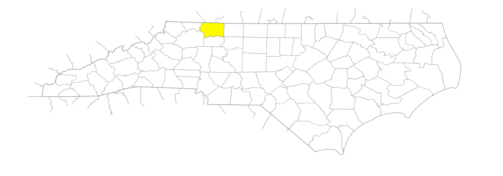
NC Gazetteer

Surry County

… was formed in 1771 from Rowan County. Located in the N central section of the state, it is bounded by the state of Virginia and by Stokes, Yadkin, Wilkes, and Alleghany Counties. Named for the County of Surrey in England, birthplace of then-incumbent governor William Tryon. The fact that the name is similar to Saura, the Indian tribe that had recently inhabited the region, may have had some influence in the choice. Area: 538 sq. mi. County seat: Dobson, with an elevation of 1,265 ft. Townships are Bryan, Dobson, Eldora, Elkin, Franklin, Long Hill, Marsh, Mount Airy, Pilot, Rockford, Shoals, Siloam, South Westfield, Stewarts, and Westfield. Produces tobacco, corn, wheat, poultry, barley, grapes, honey, wine, dairy products, hogs, livestock, textiles, hosiery, apparel, furniture, granite, and crushed stone.

branches

Camp Branch
Endicott Branch
Flat Branch
Horns Branch
Pinch Gut Branch
Pine Branch
Wood Fork Branch

businesses or business districts

Vaughan's Springs

communities

Ararat
Ash Hill
Bannertown
Belo
Bliss
Bottom
Boyden
Brim
Burch
Cody
Copeland
Crutchfield
Dale
Danover
Devotion
Dowgap
Edwardsville
Fairview
Flat Rock
Forge
Good Spring
Harbour
Haystack
Hazel
Kapps Mill
Ladonia
Lambsburg
Levelcross
Lime Rock
Little Richmond
Lowgap
Mecca
Meiggs
Moser
Mountain Park
Oak Grove
Perch
Pine Ridge
Rusk
Salem
Samuel
Shelton Town
Shoals
Siloam
State Road
Stony Knoll
Sulphur Springs
Toast
Union Hill
Welcome
Wesley
Westfield
Whitaker Crossroads
White Plains
Woodville
Zephyr

creeks

Archies Creek
Bear Creek
Beaver Creek
Beaverdam Creek
Benson Creek
Bull Run Creek
Burris Creek
Butler Creek
Camp Creek
Chapmans Creek
Cody Creek
Cooks Creek
Cundiff Creek
Double Creek
East Double Creek
Faulkner Creek
Goins Creek
Grassy Creek
Hagan Creek
Horne Creek
Kick Shin Creek
King Creek
Little Creek
Long Creek
Lovills Creek
Mill Creek
Pauls Creek
Pilot Creek
Ramey Creek
Red Hill Creek
Rutledge Creek
Saddle Mountain Creek
Seed Cane Creek
Skin Cabin Creek
Snow Creek
Stewart Creek
Stony Creek
Toms Creek
West Double Creek
Whittier Creek

forks

Roaring Fork

gaps

Roaring Gap

historical markers

Hardin Taliaferro 1811-1875 historical marker
Jesse Franklin historical marker
Pilot Mountain historical marker
Siamese Twins historical marker
Stoneman's Raid historical marker
Surry Muster Field historical marker
Tabitha A. Holton historical marker

historical sites

Camp Butner

knobs

Bald Knob
Brooks Knob
California Knob
Cumberland Knob
Lens Knob
Liberty Knob
Raven Knob
Stott Knob

lakes

Big Lake, The
Dry Lake
Loves Fish Lake

mountain features

Rich Hill

mountains

Buck Mountain
Fisher Peak
Fulcher Mountain
Pilot Mountain
Round Peak Mountain
Saddle Mountain
Skull Camp Mountain
Slate Mountain
Turner Mountain
Warrior Mountain

parishes

St. Jude's Parish

ponds

Low Gap Wildlife Pond
Raven Knob Pond

rapids

Crutchfields Falls

regions

Appalachian Dialect Region
Piedmont Dialect Region
VA Piedmont Dialect Region

ridges

Chestnut Ridge
Stony Ridge

rivers

Ararat River
Elkin River
Fisher River
Little Fisher River
Mitchell River
North Fork Mitchell River
Yadkin River

schools

Combstown School
East Surry High
Elkins High School
Millennium Charter Academy
Mount Airy High School
Mt. Ararat School
North Surry High
Sandy Level School
Surry Central High
Surry Early College
Woodville School

shoals

Bean Shoals

tops

Pine Top

towns

Dobson
Elkin
Halcombville
Mount Airy
Pilot Mountain
Rockford

townships

Bryan Township
Dobson Township
Eldora Township
Elkin Township
Franklin Township
Long Hill Township
Marsh Township
Mount Airy Township
Pilot Township
Rockford Township
Shoals Township
Siloam Township
South Westfield Township
Stewarts Creek Township
Westfield Township

transportation-related places

Island Ford

waterfalls

Budget Falls
Carters Falls