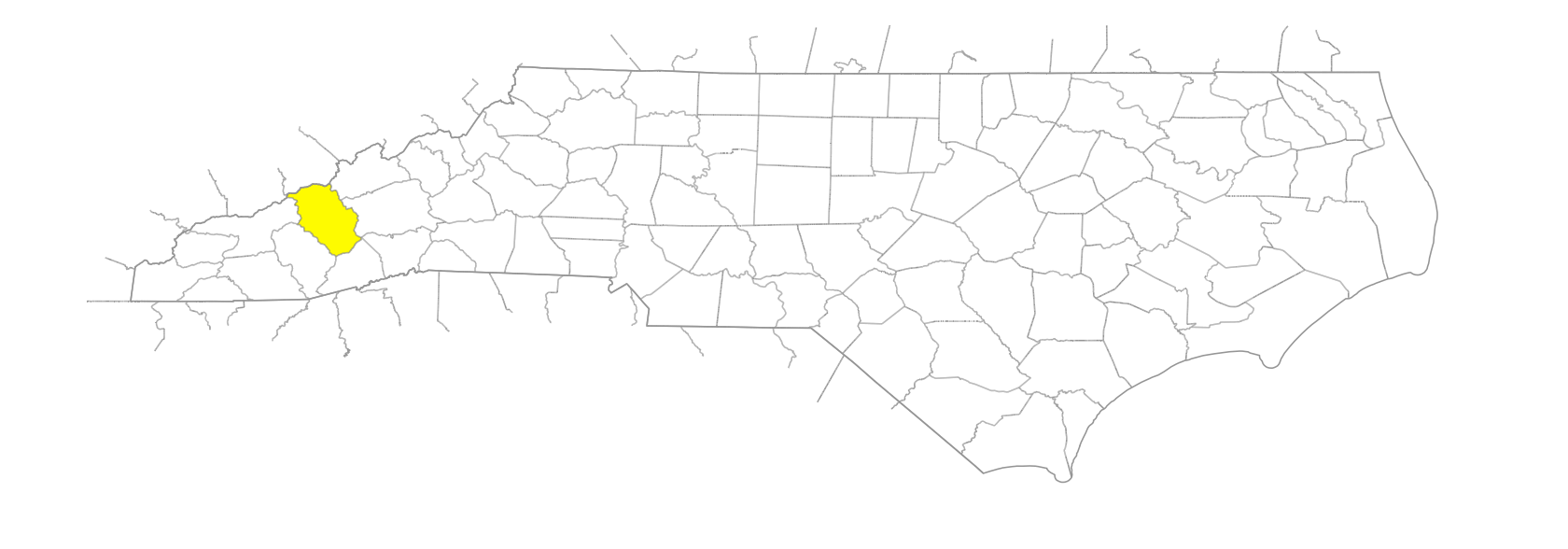
NC Gazetteer

Haywood County

… was formed in 1808 from Buncombe County. Located in the W section of the state, it is bounded by the state of Tennessee and by Madison, Buncombe, Transylvania, Jackson, and Swain Counties. It was named for John Haywood (1755-1827), state treasurer from 1787 to 1827. Area: 544 sq. mi. County seat: Waynesville, with an elevation of 2,635 ft. Townships are Beaverdam, Cataloochee, Cecil, Clyde, Crabtree, East Fork, Fines Creek, Iron Duff, Ivy Hill, Jonathans Creeks, Pigeon, Waynesville, and White Oak. Produces apples, corn, Christmas trees, dairy products, livestock, hogs, poultry, paper, rubber goods, concrete products, chemicals, lumber, leather, textiles, tobacco, furniture, sand, and gravel.

areas

Cherry Flats
Chestnut Flats
Crab Orchard Fields
Schoolhouse Flats
Walnut Bottom

balds

Big Bald
Caney Fork Bald
Crabtree Bald
Fork River Bald
Grassy Bald
Hemphill Bald
Laurel Patch Bald
Ledge Bald
Lickstone Bald
Rough Butt Bald
Sandy Mush Bald
Silvermine Bald
Steestachee Bald
Tanasee Bald
Tennessee Bald
Walker Bald
Wesner Bald
Wolf Bald

bends

Big Bend

branches

Andy Branch
Barn Branch
Barnes Branch
Bear Branch
Bear Branch
Bearpen Branch
Bee Branch
Bennett Branch
Bennett Branch
Bettis Branch
Big Bald Branch
Big Beartrap Branch
Big Branch
Big Branch
Big Branch
Big Branch
Big Branch
Big Spring Branch
Bills Branch
Boomer Inn Branch
Browning Branch
Bubbling Springs Branch
Buckeye Branch
Camp Branch
Camp Branch
Camp Two Branch
Carpenter Branch
Chambers Branch
Chestnut Branch
Chestnut Orchard Branch
Chinquapin Branch
Clontz Branch
Coffee Branch
Coggins Branch
Conner Mill Branch
Conrad Branch
Correll Branch
Counterfeit Branch
Cove Field Branch
Davidson Branch
Dicks Branch
Dina Branch
Dotson Branch
Double Gap Branch
Drift Branch
Dry Branch
Dry Branch
Dude Branch
Ephraim Branch
Evans Branch
Factor Branch
Fall Branch
Farmer Branch
Flat Branch
Gaddis Branch
George Branch
Gibson Branch
Good Spring Branch
Grassy Branch
Grassy Ridge Branch
Gray Camp Branch
Gregory Branch
Harley Branch
Hemlock Branch
Henderson Branch
Hicks Branch
Holly Bottom Branch
Hunter Branch
Indian Branch
Inman Branch
James Branch
Jim Branch
Johnson Branch
Jordan Branch
Kems Branch
Kilby Branch
Laurel Branch
Laurel Branch
Laurel Branch
Laurel Branch
Leatherwood Branch
Little Bald Branch
Little Beartrap Branch
Little Branch
Little Davidson Branch
Little Fall Branch
Little Nettle Branch
Long Branch
Long Branch
Long Branch
Long Branch
Long Levels Branch
Low Gap Branch
Lower Double Branch
Marrow Branch
Matthews Branch
Mauney Cove Branch
McElroy Branch
McKee Branch
Medford Branch
Messer Branch
Messer Branch
Mine Branch
Mitchell Cove Branch
Moody Branch
Morrow Branch
Mossy Branch
Murray Branch
Ned Branch
Nelson Branch
Nelson Branch
Nelson Branch
Orchard Branch
Painter Branch
Palmer Branch
Panther Branch
Parks Branch
Peter Cove Branch
Phillips Branch
Poison Cove Branch
Poplar Branch
Pounding Mill Branch
Prophet Branch
Rabbitskin Branch
Raven Cliff Branch
Redbank Branch
Rock Hollow Branch
Rocky Branch
Rocky Branch
Rocky Branch
Rocky Branch
Rocky Cove Branch
Rogers Branch
Rube Rock Branch
Sag Branch
Sally Branch
Sally Haines Branch
Sam Branch
Sam Branch
Scapecat Branch
Schoolhouse Branch
Shelton Branch
Slickrock Branch
Slide Branch
Snake Branch
Stamey Cove Branch
Steestachee Branch
Sugar Cove Branch
Teague Branch
Tom Hall Branch
Toms Branch
Turner Branch
Warm Cove Branch
Whaley Branch
Winding Stair Branch
Wolf Laurel Branch
Woody Branch
Wright Branch

communities

Bethel
Burnett Siding
Cataloochee
Cecil
Clark
Cove
Cove Creek
Crabtree
Cruse
Cruso
Dellwood
Dogwood Flats
Fannie
Fines Creek
Hyatt Creek
Iron Duff
Ivy Gap
Lake Junaluska
Morning Star
Mount Sterling
Palm
Pant
Phillipsville
Plott
Retreat
Round Knob
Saunook
Silver Bluff
Sonoma
Spring Hill
Springdale
Sunburst
Waterville
Woodrow

coves

Bald Cove
Bell Collar Cove
Big Buckeye Cove
Big Cove
Big Cove
Bill Cove
Brown Cove
Buck Cove
Buckeye Cove
Buckeye Cove
Buckeye Cove
Bullpen Cove
Burnett Cove
Cathey Cove
Chambers Cove
Cherry Cove
Chestnut Flat Cove
Curtis Cove
Daniels Cove
Deep Gap Cove
Dutch Cove
Edward Cove
Finch Cove
Francis Cove
Fulbright Cove
Garner Cove
Germany Cove
Harbon Cove
Henson Cove
Hickory Flat Cove
Ike Cove
Jaynes Cove
Johns Cove
Jones Cove
Leatherwood Cove
Liner Cove
Little Buckeye Cove
Mauney Cove
McClure Cove
McElroy Cove
Medford Cove
Mitchell Cove
Murray Cove
Oxear Cove
Peter Cove
Pine Tree Cove
Poison Cove
Poplar Cove
Poplar Cove
Ratcliff Cove
Reed Cove
Rhodarme Cove
Rice Cove
Riddie Cove
Roberts Cove
Rocky Cove
Rocky Cove
Rogers Cove
Rogers Cove
Shingle Cove
Silvers Cove
Smoky Cove
Sorrells Cove
Stamey Cove
Sugar Cove
Turkey Cove
West Cove
Willis Cove
Worley Cove

creeks

Allen Creek
Allens Creek
Anderson Creek
Bald Creek
Baxter Creek
Beantown Creek
Beaverdam Creek
Beech Creek
Big Creek
Big Creek
Bird Creek
Buckeye Creek
Burnett Creek
Campbell Creek
Cataloochee Creek
Cherry Cove Creek
Cherry Creek
Chestnut Cove Creek
Cold Creek
Cold Springs Creek
Cooks Creek
Cove Creek
Cove Creek
Crabtree Creek
Crawford Creek
Curtis Creek
Deep Gap Creek
Deer Creek
Dix Creek
Dogwood Flats Creek
Dutch Cove Creek
Eaglenest Creek
Fall Creek
Falling Rock Creek
Fie Creek
Fines Creek
Flat Laurel Creek
Garden Creek
Garrett Creek
George Ira Creek
Green Creek
Groundhog Creek
Hemphill Creek
Horse Creek
Hungry Creek
Hurricane Creek
Hyatt Creek
Jonathans Creek
Laurel Creek
Lenoir Creek
Liner Creek
Little Cataloochee Creek
Little Creek
Lost Bottom Creek
Martin Creek
McClure Creek
McGinty Creek
Messer Creek
Morgan Creek
Mount Sterling Creek
Mouse Creek
Nettle Creek
Newfound Creek
Nick Creek
Nolen Creek
North Hominy Creek
Old Bald Creek
Palmer Creek
Panther Creek
Pine Tree Cove Creek
Pisgah Creek
Plott Creek
Pretty Hollow Creek
Queen Creek
Raccoon Creek
Reed Creek
Rice Cove Creek
Richland Creek
Right Fork Cove Creek
Rogers Cove Creek
Rough Creek
Runyon Creek
Shining Creek
Shining Rock Creek
Shiny Creek
Silvers Cove Creek
Sinking Creek
Skiffley Creek
Snowbird Creek
Sorrell Creek
South Turkey Creek
Stevens Creek
Straight Creek
Thickety Creek
Tom Creek
Turkey Creek
Turnpike Creek
Wesley Creek
West Fork Campbell Creek
Wilkins Creek
Winchester Creek
Woody Creek
Wycle Creek
Yellow Creek

elevations

Long Levels

forests

Confederate Memorial Forest
Pisgah National Forest

forks

Big East Fork
Caldwell Fork
East Fork [Campbell Creek]
Gunter Fork
Rough Fork
Rush Fork
Swallow Fork
Ugly Fork

former communities

Cotton Patch
Crestmont
Hazelwood
Hepco
Nellie
Ola

gaps

Bald Gap
Bear Wallow Gap
Bearpen Gap
Beartrail Ridge Gap
Beech Gap
Beech Gap
Beech Spring Gap
Bennett Gap
Betsey Gap
Black Camp Gap
Bridges Camp Gap
Brooks Gap
Buck Spring Gap
Buckeye Gap
Cathey Gap
Cherry Gap
Colmans Gap
Cove Creek Gap
Crabtree Gap
Crawford Creek Gap
Crawford Gap
Davenport Gap
Davidson Gap
Deep Gap
Deer Creek Gap
Double Gap
Double Spring Gap
Doubleside Gap
East Fork Gap
Fines Creek Gap
Flat Gap
Flat Laurel Gap
Flower Gap
Fryingpan Gap
Garretts Gap
Grassy Cove Gap
Grassy Gap
Green Gap
Haywood Gap
Haywood Gap
Holland Gap
Hominy Gap
Hood Gap
Horse Creek Gap
Horsebone Gap
Huey Gap
Ivestor Gap
Ivy Gap
Johnson Gap
Jolly Gap
Laurel Gap
Ledge Gap
Licklog Gap
Little Balsam Gap
Little Bearpen Gap
Little Creek Gap
Locust Gap
Low Gap
Low Gap
Low Gap
Maggot Spring Gap
Maple Spring Gap
Marys Gap
Meadow Fork Gap
Miller Gap
Mount Hardy Gap
Mount Sterling Gap
Neds Lick Gap
Newfound Gap
Nick Gap
Noland Gap
Oaklog Gap
Panther Spring Gap
Pauls Gap
Pigeon Gap
Pigeon Gap
Pin Oak Gap
Pine Tree Gap
Polls Gap
Poplar Gap
Pretty Hollow Gap
Reinhardt Gap
Robert Gap
Runyon Gap
Rush Fork Gap
Sal Patch Gap
Shining Creek Gap
Shining Rock Gap
Shook Gap
Shuckpen Gap
Smith Gap
Soapstone Gap
Soco Gap
Solray Gap
Spanish Oak Gap
Spring Creek Gap
Stamey Cove Gap
Steer Gap
Tunnel Gap
Turkey Creek Gap
Turkey Gap
Wade Gap
Wagon Road Gap
Walker Low Gap
Windy Gap
Wolf Pit Gap
Wolfpen Gap

historical markers

Arnold Guyot 1807-1884 historical marker
Cataloochee Trail historical marker
Felix Walker historical marker
Garden Creek historical marker
Inman Chapel historical marker
Martin's Surrender historical marker
Morning Star Church historical marker
N.C. Education Association historical marker
No-Till Farming historical marker
Plott Hound historical marker
Qualla Boundary historical marker
Rutherford Trace historical marker
Sunburst historical marker

knobs

Ad Tate Knob
Bald Knob
Bald Knob
Beartrap Knob
Beaty Spring Knob
Beech Knob
Beech Knob
Bent Knee Knob
Big Knob
Bills Knob
Black Balsam Knob
Briary Knob
Buck Knob
Camel Hump Knob
Cold Spring Knob
Cooks Knob
Cosby Knob
Dog Loser Knob
Flower Knob
Grassy Knob
Grassy Knob
Green Knob
Green Knob
Gudger Knob
Haynes Knob
Henry Knob
Herrin Knob
Inadu Knob
Indian Knob
Jerry Knob
Jones Knob
Killian Knob
Little Bald Knob
Little Balsam Knob
Little Sam Knob
Luftee Knob
Mary Gray Knob
Mary Knob
Oak Knob
Ore Knob
Parker Knob
Peaked Knob
Pinnacle Knob
Potato Knob
Pug Knob
Purchase Knob
Rattlesnake Knob
Reinhart Knob
Rich Knob
Ricky Knob
Rocky Knob
Rocky Knob
Rocky Knob
Rough Knob
Sam Knob
Sheepback Knob
Shot Pouch Knob
Spot Knob
Strawberry Knob
Sunup Knob
Thermo Knob
Thompson Knob
Tricorner Knob
Tritt Knob
Waterrock Knob
Whim Knob
Winding Knob
Wright Knob

lakes

Lake Junaluska
Lake Logan
Lake Palcoy
Waterville Lake

mines

Big Ridge Mine

mountain features

Big Butt Mountain
Buck Ridge,
Cataloochee Divide
Cedar Cliff
Cedar Cliff
Chestnut Bald,
Long Bunk
Pigeon Ledge
Point Lookout
Shining Rock Ledge
Short Bunk

mountain ranges

Bald Mountains

mountains

Anderson Mountain
Balsam Corner
Balsam Mountain
Big Butt Mountain
Big Cataloochee Mountain
Birdstand Mountain
Black Mountain
Brave Mountain
Brushy Mountain
Buck Cove Mountain
Buck Mountain
Buzzard Roost
Cataloochee Balsam
Chambers Mountain
Chestnut Mountain
Chiltoes Mountain
Cold Mountain
Doubletop Mountain
Dry Mountain
Eaglenest Mountain
Enos Plotts Balsam Mountain
Fie Top Mountain
Fincher Mountain
Fork Mountain
Fork Mountain
Fork Mountain
Fryingpan Mountain
Granny Mountain
Harmon Den Mountain
Hebo Mountain
Horsefork Mountain
Hurricane Mountain
Hyder Mountain
Junaluska Mountain
Lee Mountain
Lickstone Mountain
Little Bald Mountain
Little Mountain
Little Pisgah Mountain
Little Rocky Face
Lone Bald Mountain
Longarm Mountain
Marg Mountain
Mill Mountain
Millstone Mountain
Mount Cammerer
Mount Guyot
Mount Hardy
Mount Pisgah
Mount Sterling
Mount Yonaguska
Naked Place Mountain
Newfound Mountain
Noland Mountain
Old Bald Mountain
Old Black Mountain
Old Field Top Mountain
Piney Mountain
Plott Balsam
Potato Patch
Pressly Mountain
Ratcliff Mountain
Ravencliff Mountain
Richland Balsam
Rocky Face Mountain
Rough Mountain
Scottish Mountain
Seay Mountain
Seniard Mountain
Setzer Mountain
Shanty Mountain
Sheep Mountain
Shining Rock Mountain
Split Mountain
Spruce Mountain
Stairs Mountain
Tennent Mountain
Utah Mountain
White Rock
Williams Mountain
Wolfpen Mountain

parks

Great Smoky Mountains National Park

points of interest

Sugartree Licks

populated places

Maggie Valley
West Canton

prongs

Dark Prong
Greasy Cove Prong
Middle Prong [West Fork Pigeon River]
Right Hand Prong [Pigeon River]
Yellowstone Prong

regions

Appalachian Dialect Region

ridges

Balsam Ridge
Bearpen Ridge
Bearpen Ridge
Beartrap Ridge
Beech Ridge
Big Beartrail Ridge
Big Fork Ridge
Big Ridge
Bob's Ridge
Camerer Ridge
Cathey Ridge
Chestnut Flat Ridge
Chestnut Ridge
Chestnut Ridge
Coffee Ridge
Cove Field Ridge
Double Gap Ridge
Dry Gap Ridge
Eaglenest Ridge
Fire Scald Ridge
Fish Ridge
Fork Ridge
Goatrock Ridge
Grassy Cove Ridge
Graveyard Ridge
Green Ridge
Half Acre Ridge
Hard Ridge
Hickory Ridge
Horse Pen Ridge
Hurricane Ridge
Indian Ridge
Ivestor Ridge
Jesse Ridge
Lickstone Ridge
Little Beartrail Ridge
Little Mountain
Little Ridge
Little Spruce Ridge
Maggot Ridge
McClure Ridge
Middle Ridge
Mine Ridge
Mingus Ridge
Mount Sterling Ridge
Nellie Ridge
Nobreeches Ridge
Old Bald Ridge
Pinnacle Ridge
Pisgah Ridge
Plott Balsams
Rabbit Ridge
Raven Cliff Ridge
Roberson Ridge
Rocky Branch Ridge
Roland Ridge
Rough Ridge
Runyon Ridge
Sandy John Ridge
Sassafras Ridge
Service Ridge
Seven Mile Ridge
Snaggy Ridge
Snake Ridge
Spruce Mountain Ridge
Spruce Ridge
Teaberry Ridge
Three Top Ridge
Tough Ridge
Trail Ridge
Wading Branch Ridge
Wash Ridge
Woody Ridge

rivers

East Fork Pigeon River
Little East Fork Pigeon River
Pigeon River
West Fork Pigeon River

rocks

Goat Rock

schools

Central Haywood High
Haywood Early College High School
Pisgah High School
Tuscola High School
Waynesville School

springs

Buck Spring
Cedar Valley Spring
Sweetwater Spring
Whiteoak Spring
Wildcat Spring

streams

Haywood Gap Stream

tops

Bald Top
Balsam High Top
Billie Top
Billy Top
Canadian Top
Cansadie Top
Cowpen Top
Dads Top
Ed Top
Glade Top
Grassy Cove Top
Grassy Top
Hall Top
Hazel Top
High Top
High Top
Leatherwood Top
Middle Top
Moody Top
Piney Field Top
Poison Cove Top
Rich Top
Snakeden Top
South Spring Top
Sugar Top
Toms Top
Twelve O'Clock Top
Walker Top
Wildcat Top
Wines Top

towns

Canton
Clyde
Waynesville

townships

Beaverdam Township
Cataloochee Township
Cecil Township
Clyde Township
Crabtree Township
East Fork Township
Fines Creek Township
Iron Duff Township
Ivy Hill Township
Jonathans Creek Township
Pigeon Township
Waynesville Township
White Oak Township

transportation-related places

Blue Ridge Parkway
Osburn Ford

valleys

Coon Hollow
Dark Cove
Haines Cove
Possum Hollow
Raven Hollow
Red Oak Cove
Rock Hollow
Wash Hollow
Yates Cove

waterfalls

Bridge Falls
Second Falls
Tunnel Falls
Upper Falls
Yellowstone Falls