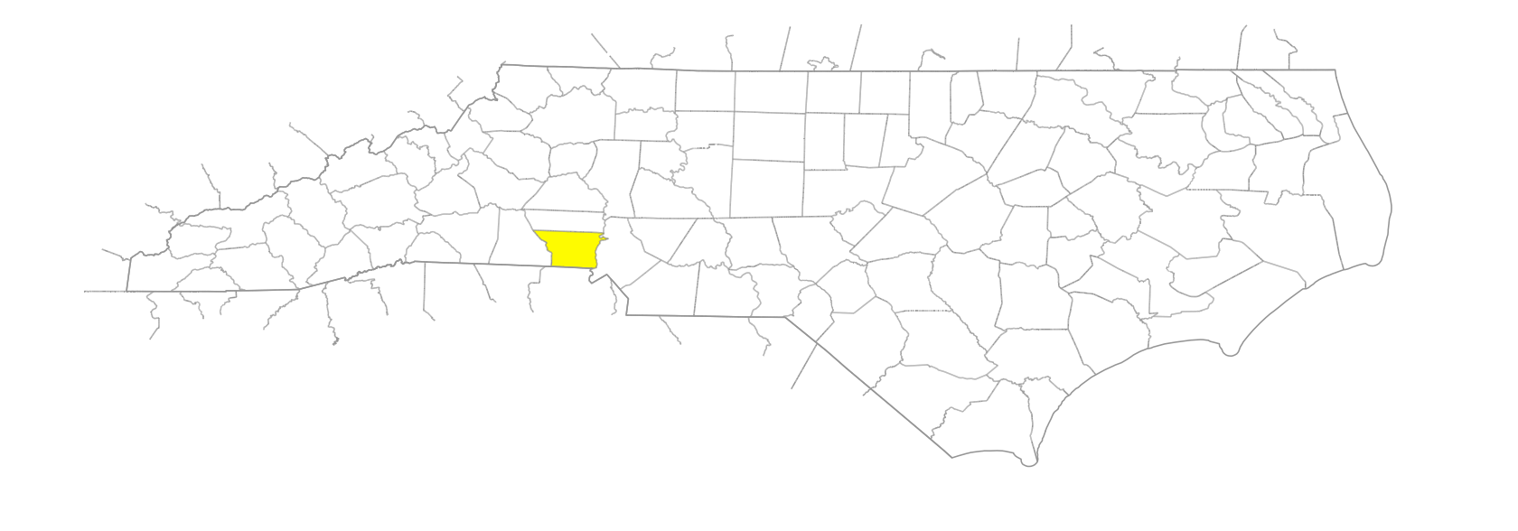
NC Gazetteer

Gaston County

… was formed in 1846 from Lincoln County. Located in the SW section of the state, it is bounded by the state of South Carolina and by Cleveland, Lincoln, and Mecklenburg Counties. It was named for William Gaston (1778-1844), a member of Congress and a judge of the Supreme Court of North Carolina. Area: 363 sq. mi. County seat: Gastonia, with an elevation of 825 ft. Townships are Cherryville, Crowell Mountain, Dallas, Gastonia, River Bend, and South Point. Produces corn, wheat, oats, hay, soybeans, air filters, trucking, nursery products, poultry, hogs, livestock, textiles, hosiery, machinery, corrugated boxes, chemicals, motor-vehicle parts, crushed stone, mica, and sand.

branches

Coleys Branch
McGill Branch
Squirrel Branch
Sulphur Branch

cities

Belmont
Gastonia

communities

Begonia
Boogertown
Costner
Crowders
Elmores Crossroads
Gould
Lucia
Nims
North Belmont
Old Furnace
Perry
Ranlo-Rex-Priscilla and Smyre Mills
River Bend
Snapp
South Gastonia
South Point
Spencer Mountain
Sunnyside
Tuckasege

creeks

Abernethy Creek
Anthony Creek
Beaverdam Creek
Blackwood Creek
Catawba Creek
Crowders Creek
Duharts Creek
Dutchmans Creek
Fites Creek
Howsers Creek
Hoyles Creek
Johnsons Creek
Killians Creek
Leepers Creek
Little Beaverdam Creek
Little Hoyles Creek
Little Long Creek
Long Creek
Mountain Creek
Rattle Shoal Creek
South Crowders Creek
South Prong Stanley Creek
Stanley Creek
Taylors Creek

former communities

East Kings Mountain

gaps

Sherrars Gap
Stepps Gap

historical markers

Belmont Abbey College historical marker
Dallas historical marker
Daniel E. Rhyne 1852-1931 historical marker
Flood Of 1916 historical marker
Goshen Presbyterian Church historical marker
John Fulenwider historical marker
Joseph Dickson 1745-1825 historical marker
Loray Strike historical marker
North Carolina Orthopedic Hospital historical marker
North Carolina-South Carolina historical marker
Oak Grove historical marker
R. Gregg Cherry historical marker
St. Joseph's historical marker
Stuart W. Cramer 1868-1940 historical marker
Tryon County historical marker
William Chronicle historical marker

historical sites

Camp Chronicle

knobs

Jackson Knob

lakes

Lake Wylie
Mountain Island Lake
Robinwood Lake

mountain ranges

Berry Mountains
Kings Mountain

mountains

Crowders Mountain
Mount Heckler
Mount Holly Ferry
Pasour Mountain
Spencer Mountain

populated places

East Gastonia
South Belmont

regions

Piedmont Crescent
Piedmont Dialect Region

ridges

Chestnut Ridge

rivers

Catawba River
South Fork Catawba River

schools

Ashbrook High School
Beaver Dam School
Belmont School Teacherage
Bessemer City High School
Bessemer City School
Cherryville High School
Dallas School
East Gaston High School
Forestview High School
Gaston Early College High School
Highland School of Technology
Hunter Huss High School
Mauney School
Mountain Island Charter School
North Gaston High School
Piedmont Community Charter School
South Point High School
South Point School
Stuart W. Cramer High School
Warlick Academy
Webb St. School

shoals

Friday Shoals

towns

Alexis
Bessemer City
Cherryville
Cramerton
Dallas
Dellview
Hardin
Lowell
McAdenville
Mount Holly
Mountain Island
Stanley
Wilson's Factory

townships

Cherryville Township
Crowder Mountain Township
Dallas Township
Gastonia Township
River Bend Township
South Point Township

transportation-related places

Henderson's Ferry
Tools Ford

waterfalls

Ross Falls