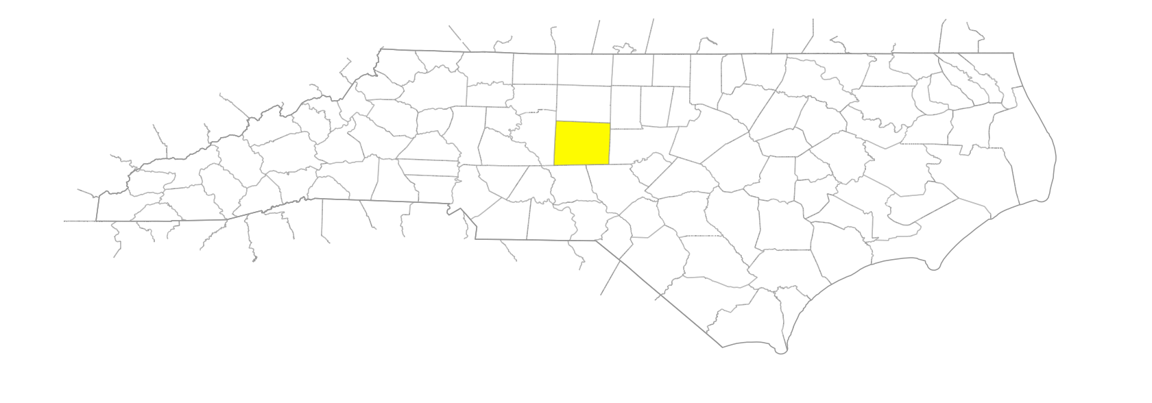
NC Gazetteer

Randolph County

… was formed in 1779 from Guilford County. Located in the central section of the state, it is bounded by Chatham, Moore, Montgomery, Davidson, Guilford, and Alamance Counties. It was named for Peyton Randolph (1721?-75), president of the Continental Congress. Area: 801 sq. mi. County seat: Asheboro, with an elevation of 879 ft. Townships are Asheboro, Back Creek, Brower, Cedar Grove, Coleridge, Columbia, Concord, Franklinville, Grant, Level Cross, Liberty, New Hope, New Market, Pleasant Grove, Providence, Randleman, Seagrove, and Trinity. Produces wheat, corn, oats, poultry, dairy products, hay, barley, tobacco, nursery products, hogs, livestock, hosiery, apparel, textiles, tires, batteries, toys, furniture, shoes, and electric blankets.

areas

Pinson

branches

Big Branch
Bob Branch
Long Branch

communities

Aumans Crossroads
Balfours
Bombay
Brown
Brown's Crossroads
Brush Creek
Buffalo Ford
Bulla
Bunch
Cape
Caraway
Cedar Falls
Central Falls
Cheeks
Coleridge
Dewey
Edgar
Eleazer
Empire
Erect
Fair Grove
Flint Hill
Flora
Flower Hill
Garners Store
Glenola
Grays Chapel
Hoover Hill
Hoyle
Iron Mountain
Jackson Creek
Julian
Kemps Mill
Lassiters Mills
Level Cross
Level Plains
Lineberry
Marrow
Martha
Mechanic
Melanchton
Michfield
Millboro
Moffitt
New Hope
New Salem
Pisgah
Pleasant Lodge
Progress
Quinine
Rachel
Randolph Courthouse
Redcross
Salem
Salem Church
Sandy Creek
Sawyersville
Science
Sophia
Strieby
Troy's Store
Ulah
Velna
Wards Store
White House
Whynot
Worthville

creeks

Bachelor Creek
Back Creek
Bettie McGee's Creek
Brush Creek
Bush Creek
Cable Creek
Caraway Creek
Crow Creek
Fork Creek
Jackson Creek
Laniers Creek
Little Brush Creek
Little Caraway Creek
Little Polecat Creek
Mill Creek
Mill Creek
Mount Pleasant Creek
Muddy Creek
Polecat Creek
Reed Creek
Reed Creek
Richland Creek
Sandy Creek
Second Creek
Silver Run Creek
Taylors Creek
Toms Creek

forks

Poison Fork
Totero Fork

former communities

Brower's Mill
Johnstonville

geological formations

Soapstone Mount

historical markers

Cedar Falls Mill historical marker
Cox's Mill historical marker
Henderson Luelling historical marker
Herman Husband 1724-1795 historical marker
Jonathan Worth historical marker
Mustering Out Of Confederate Army historical marker
Plank Road historical marker
Rednap Howell D. 1787 historical marker
Sandy Creek Baptist Church historical marker
Trading Path historical marker
Trinity College historical marker

lakes

U-Alta Lake

mills

Cox's Mill

mountain ranges

Uwharrie Mountains

mountains

Back Creek Mountain
Black Jack Mountain
Black Mountain
Brush Mountain
Caraway Mountain
Cedar Rock Mountain
Coolers Knob Mountain
Dutchman Mountain
Grays Mountain
Kies Mountain
King Mountain
Lick Mountain
Linden Mountain
Little Long Mountain
Little Shepherd Mountain
Lowe Mountain
Nancys Mountain
Needhams Mountain
Pilot Mountain
Pond Mountain
Potato Hill Mountain
Prickly Pear Mountain
Purgatory Mountain
Ridge's Mountain
Shepherd Mountain
Slick Rock Mountain
Steep Rock Mountain
Vineyard Mountain

populated places

Asheboro South
Asheboro West

regions

Piedmont Crescent
Piedmont Dialect Region

rivers

Little Uwharrie River
Rocky River
Uwharrie River
West Fork Little River

runs

Tibbs Run

schools

Asheboro High School
Central School
Eastern Randolph High School
Providence Grove High School
Randleman High School
Randolph Early College High School
Southwestern Randolph High School
Trinity High School
Uwharrie Charter Academy
Uwharrie Ridge Six-Twelve
Wheatmore High School

towns

Archdale
Asheboro
Coxsborough
Farmer
Franklinville
Jacksonville
Liberty
New Market
Ramseur
Randleman
Seagrove
Staley
Trinity

townships

Asheboro Township
Back Creek Township
Brower Township
Coleridge Township
Columbia Township
Concord Township
Franklinsville Township
Grant Township
Level Cross Township
Liberty Township
New Hope Township
New Market Township
Pleasant Grove Township
Providence Township
Randleman Township
Richland Township
Tabernacle Township
Trinity Township
Union Township

villages

Keeauwee