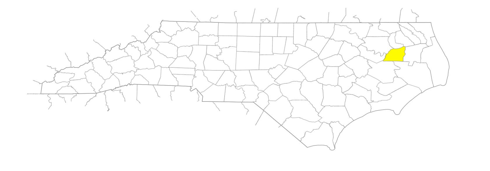
NC Gazetteer

Washington County

… was formed in 1799 from Tyrrell County. Located in the E section of the state, it is bounded by Tyrrell, Hyde, Beaufort, Martin, and Bertie Counties and by Albemarle Sound. It was named for George Washington (1732-99). Area: 420 sq. mi. (336, land; 84, water). County seat: Plymouth, with an elevation of 21 ft. Townships are Lees Mills, Plymouth, Scuppernong, and Skinnersville. Produces tobacco, peanuts, corn, soybeans, wheat, Irish potatoes, wood products, seafood, hogs, livestock, lumber, and paper.

areas

Black Fields
New Lands

bays

Bull Bay

beaches

Albemarle Beach

branches

Hawkins Branch
Persimmon Branch

businesses or business districts

Hoof Inn

canals

Canal A
Canal B
Enoch Canal
Lewis Canal
Main Canal
Moccasin Canal
Mountain Canal
Skinner Canal
Somerset Canal
Thirty Foot Canal

communities

Ausbon
Basnight
Beasley
Beechgrove
Chesson
Davenport Forks
Emandell
Green Hill
Hinson
Hoke
Mackeys
Maple
Mizell
Pleasant Grove
Scuppernong
Skinnersville
Sound
Swain
Wenona
Westover

creeks

Banton Creek
Bull Creek
Conaby Creek
Deep Bottom
Deep Creek
Kendricks Creek
Mall Creek
Old Mill Creek
Welch Creek
Whites Creek

elevations

Long Acre

estates

Buncombe Hall
Cabin Ridge Plantation

former communities

Monticello

groups of islands

Louzanla Islands
Purchace Islands
Rainbow Islands

historical markers

85th Redoubt historical marker
Augustin Daly historical marker
Battle Of Plymouth historical marker
Buncombe Hall historical marker
Charles Pettigrew historical marker
Fort Williams historical marker
Hoke's Final Line historical marker
James Johnston Pettigrew historical marker
Lake Company historical marker
Mackeys Ferry historical marker
Naval Action historical marker
Ram Albemarle historical marker
Ransom's Assault historical marker
Rehoboth Church historical marker
Somerset Place historical marker
Union Earthworks historical marker

islands

Louse Island

lakes

Pungo Lake

Native American settlements

Moratuc

parks

Pettigrew State Park

places of unknown type

Oporauck

plantations

Somerset

points

Bull Point
Hornblower Point
Laurel Point
Leonards Point

regions

Coastal Plain
Coastal Plain Dialect Region
Outer Banks Dialect Region

ridges

Dogwood Ridge
Long Ridge
Pea Ridge
Sassafras Ridge

rivers

Roanoke River

schools

Macedonia School
Plymouth High School
Washington Early College High
contributor

sounds

Albemarle Sound

swamps

Bakers Swamp
Chappel Swamp
East Dismal Swamp
Great Swamp
Indian Swamp
Van Swamp

towns

Cherry
Creswell
Plymouth
Roper

townships

Lees Mills Township
Plymouth Township
Scuppernong Township
Skinnersville Township

transportation-related places

Mackeys Ferry
Spruills Bridge
Tare-over
Tottering Bridge