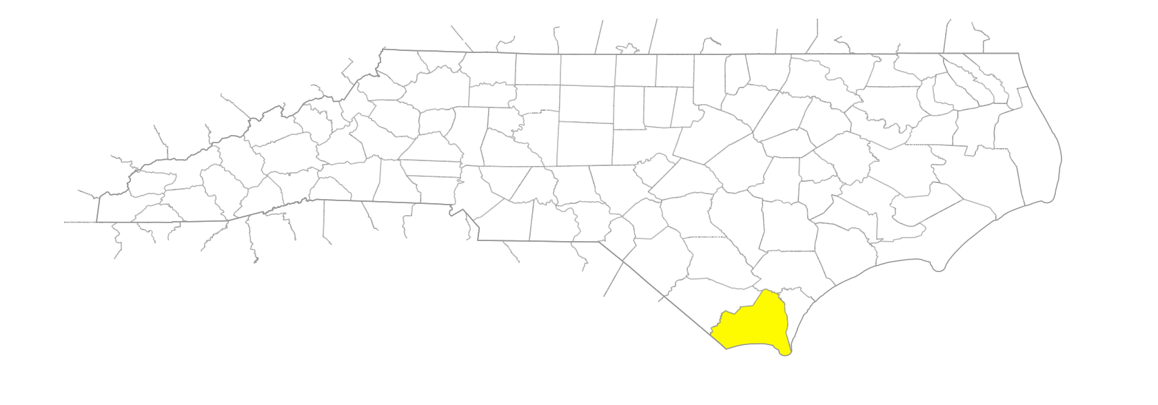
NC Gazetteer

Brunswick County

… was formed in 1764 from New Hanover and Bladen Counties. In the SE section of the state, it is bounded by the Atlantic Ocean; South Carolina; Columbus, Pender, and New Hanover Counties; and the Cape Fear River. Named for the town of Brunswick, which see. Area: 907 sq. mi. County seat in rural setting near Bolivia. Townships are Lockwood Folly, Northwest, Shallotte, Smithville, Town Creek, and Waccamaw. Produces corn, soybeans, oats, hogs, beef cattle, fishmeal, lumber, fertilizer, hay, tobacco, strawberries, and processed seafood.

bays

Beaverdam Bay
Big Bay
Cawcaw Bay
Thomas Bay

beaches

Big Beach
Caswell Beach
Hales Beach
Holden Beach
Long Beach

bodies of water

Basin, The
Dead Backwater

branches

Beaver Dam Branch
Big Branch
Clarks Branch
Dickinson Clearwater Branch
Flat Branch
Fox Grape Branch
Hangman Branch
Harris Swamp Branch
Indigo Branch
Jinnys Branch
Lewis Branch
Lindscomb Branch
Morgan Branch
Muddy Branch
Mulberry Branch
Ox Pen Branch
Piney Branch
Rattlesnake Branch
Rattlesnake Branch
Sharron Branch
Skipper Branch
Tomblin Branch

channels

Eastern Channel
Eastern Channel

communities

Ash
Battle Royal
Bell Swamp
Bishop
Biven
Calabash
Chairman
Clarendon
Cool Run
Eastbrook
Easy Hill
Exum
Freeland
Fulford
Funston
Grissettown
Hickmans Crossroads
Hilton
Honey Pond
Iredell
Jinnys Branch
Lanvale
Leland
Lennon Crossroads
Little Prong
Longwood
Maco
Makatoka
Malmo
Midway
Mill Branch
Mill Creek
Narassa
Navassa
Northwest
Oak Grove
Phoenix
Red Bug
Regans Crossroads
Russtown
Seaside
Secession
Shell Point
Silver Town
Smiths
Stansbury
Suburb
Supply
Thomasboro
Varnum
Winnabow
Woodburn

creeks

Baldhead Creek
Bay Creek
Beaver Dam Creek
Bell Swamp Creek
Calabash Creek
Cape Creek
Coward Creek
Davis Creek
Denis Creek
Dews Creek
Dutchman Creek
Hood Creek
Jackeye Creek
Juniper Creek
Lilliput Creek
Livingston Creek
Mallory Creek
Mill Creek
Molasses Creek
Orton Creek
Pinch Gut Creek
Price Creek
Rices Creek
Russells Creek
Sand Hill Creek
Saucepan Creek
Shallotte Creek
Sharron Creek
Spring Creek
Sturgeon Creek
Town Creek
Walden Creek

depressions

Muddy Slue

elevations

Cape Fear
Welch's Bluff

estates

Gabourel's Bluff
Orton Plantation

former communities

Brunswick
Russellborough

freshwater areas

Bonnets Points

historical markers

Alfred Moore historical marker
Arthur Dobbs historical marker
Bald Head Lighthouse historical marker
Benjamin Smith 1756-1826 historical marker
Boundary House historical marker
Brunswick historical marker
Charles Town historical marker
Daniel L. Russell 1845-1908 historical marker
First Post Road historical marker
Fort Anderson historical marker
Fort Caswell historical marker
Fort Johnston historical marker
Hurricane Hazel historical marker
John Lapierre historical marker
Josiah Martin historical marker
North Carolina-South Carolina historical marker
Orton Plantation historical marker
Orton historical marker
Robert Howe historical marker
Robert Ruark 1915-1965 historical marker
Russellborough historical marker
Spanish Attack historical marker
St. Philips Church historical marker
Stamp Act historical marker
Stede Bonnet 1688-1718 historical marker
Washington's Southern Tour historical marker

historical sites

Fort Caswell
Fort Johnston
Fort Lamb
Fort Shaw

inlets

Buzzard Bay
Corncake Inlet
Lockwoods Folly Inlet
Mad Inlet
Shallotte Inlet
Tubbs Inlet

islands

Bald Beach
Battery Island
Big Island
Bird Island
Brantley Island
Campbell Island
Clarks Island
Oak Island
Sheep Island
Shellback Island
Smith Island
Striking Island
Zeke Island

marshes

Snow Marsh

necks

Colkins Neck

parishes

St. James’ Parish
St. Philip's Parish

plantations

Lilliput

points

Bowen Point
Deep Water Point
Howells Point
Onetree Point
Orton Point
Snow Point
Sturgeons Point
Sunny Point
Windy Point

ponds

Clear Pond
McKenzie Pond
Orton Pond
Pretty Pond

populated places

Charles Town

prongs

South Prong [Wet Ash Swamp]

regions

Coastal Plain
Coastal Plain Dialect Region

ridges

Prospect Ridge

rivers

Brunswick River
Cape Fear River
Elizabeth River
Lockwoods Folly River
Shallotte River

runs

Red Run

schools

Brunswick County Early College High School
North Brunswick High School
South Brunswick High School
The COAST
West Brunswick High

shoals

Middle Ground

sounds

Shallotte Sound

streams

Alligator Creek
Mercers Mill Pond
Redmond Creek

swamps

Alligator Bay
Alligator Swamp
Bear Pen Islands Swamp
Beaver Dam Swamp
Bee Island Bay
Big Swamp
Cawcaw Swamp
Clayton Bay
Drowned Bay
Green Swamp
Honey Island Swamp
Horse Pen Bay
Huitt Bay
Lewis Swamp
Little Cawcaw Swamp
Little Green Swamp
McMilly Swamp
Middle Swamp
Persimmon Swamp
River Swamp
Royal Oak Swamp
Scippco Swamp
Shingletree Swamp
Wet Ash Swamp
Wide Bay

towns

Boiling Springs Lake
Bolivia
Ocean Isle Beach
Shallotte
Southport
Sunset Beach
Walkersburg
Yaupon Beach

townships

Lockwoods Folly Township
Northwest Township
Shallotte Township
Smithville Township
Town Creek Township
Waccamaw Township

transportation-related places

Bells Ferry
Bonaparte Landing
Green Banks Landing

waterways

Kilbart Slough
Montgomery Slough